
Stampa:Paisaje en Texcala, Puebla, México.JPG

Daqs tad-dehra proviżorja: 800 × 372 pixels. Riżoluzzjonijiet oħra: 320 × 149 pixels | 640 × 297 pixels | 1,024 × 476 pixels | 1,280 × 595 pixels | 2,560 × 1,189 pixels | 4,733 × 2,199 pixels
Fajl oriġinali (4,733 × 2,199 pixel, dimensjoni: 2 MB, tip ta' MIME: image/jpeg)
| Dan huwa fajl mill-Wikimedia Commons. Il-deskrizzjoni fuq il-paġna ta' diskussjoni oriġinali tidher hawn taħt.
|
Taqsira
| Deskrizzjoni |
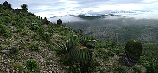
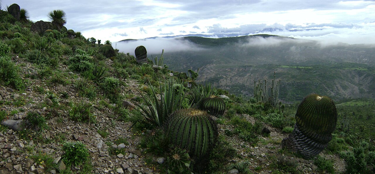
English: The landscape of the xeric Tehuacán Valley matorral ecoregion, near San Antonio Texcala in Puebla state, Central México.
Español: Paisaje de los montes cercanos a la población de San Antonio Texcala, en Puebla, México.
|
| Data | |
| Sors | Opra proprja |
| Awtur | Luistlatoani |
| Camera location | | View this and other nearby images on: OpenStreetMap |
|---|
Liċenzja
| I, the copyright holder of this work, release this work into the public domain. This applies worldwide. In some countries this may not be legally possible; if so: I grant anyone the right to use this work for any purpose, without any conditions, unless such conditions are required by law. |
Kronoloġija tal-fajl
Agħfas fuq il-grupp data/ħin biex tara l-fajl biex tara kif jidher dak il-ħin.
| Data/Ħin | Minjatura | Qisien | Utent | Kumment | |
|---|---|---|---|---|---|
| kurrenti | 00:18, 21 Ottubru 2010 | | 4,733 × 2,199 (2 MB) | Luistlatoani | {{Information |Description={{es|1=Paisaje de los montes cercanos a la población de San Antonio Texcala, en Puebla, México. Esta zona forma parte de la Reserva de la Biósfera Tehuacán-Cuicatlán, una zona ecológica protegida que cuenta con especies an |
Użu tal-fajl
Il-3 paġni segwenti jwasslu għal din l-istampa:
L-użu globali tal-fajl
Il-wikis segwenti jużaw dan il-fajl:
- Użu fuq arz.wikipedia.org
- Użu fuq cs.wikipedia.org
- Użu fuq de.wikipedia.org
- Użu fuq en.wikipedia.org
- Użu fuq en.wikivoyage.org
- Użu fuq eo.wikipedia.org
- Użu fuq es.wikipedia.org
- Użu fuq fa.wikipedia.org
- Użu fuq fi.wikibooks.org
- Użu fuq fr.wikipedia.org
- Użu fuq fr.wikivoyage.org
- Użu fuq gl.wikipedia.org
- Użu fuq he.wikipedia.org
- Użu fuq hr.wikipedia.org
- Użu fuq hu.wikipedia.org
- Użu fuq it.wikipedia.org
- Użu fuq it.wikivoyage.org
- Użu fuq lt.wikipedia.org
- Użu fuq mk.wikipedia.org
- Użu fuq nl.wikipedia.org
- Użu fuq pl.wikipedia.org
- Użu fuq pt.wikipedia.org
- Użu fuq ru.wikipedia.org
- Użu fuq sk.wikipedia.org
- Użu fuq th.wikipedia.org
- Użu fuq tr.wikipedia.org
- Użu fuq uk.wikipedia.org
- Użu fuq vi.wikipedia.org
- Użu fuq www.wikidata.org
Ara l-użu globali ta' dan il-fajl.