
Stampa:Guillaume Delisle North West Africa 1707.jpg

Daqs tad-dehra proviżorja: 744 × 600 pixels. Riżoluzzjonijiet oħra: 298 × 240 pixels | 596 × 480 pixels | 953 × 768 pixels | 1,271 × 1,024 pixels | 2,541 × 2,048 pixels | 7,704 × 6,209 pixels
Fajl oriġinali (7,704 × 6,209 pixel, dimensjoni: 16.92 MB, tip ta' MIME: image/jpeg)
| Dan huwa fajl mill-Wikimedia Commons. Il-deskrizzjoni fuq il-paġna ta' diskussjoni oriġinali tidher hawn taħt.
|
Taqsira
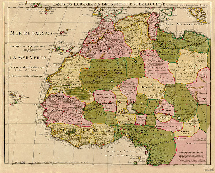
| Deskrizzjoni | Map of North West Africa (original title: Carte de la Barbarie de la Nigritie et de La Guinee) | |||||||||||||||||||||||
| Data | ||||||||||||||||||||||||
| Sors |
Library of Congress Geography and Map Division; Call Number G8220 1707 .L5
|
|||||||||||||||||||||||
| Awtur |
|
|||||||||||||||||||||||
| Verżjonijiet oħra |
Derivative works of this file: |
|||||||||||||||||||||||


Liċenzja
|
This work is in the public domain in its country of origin and other countries and areas where the copyright term is the author's life plus 100 years or fewer. | |
| This file has been identified as being free of known restrictions under copyright law, including all related and neighboring rights. | |
Kronoloġija tal-fajl
Agħfas fuq il-grupp data/ħin biex tara l-fajl biex tara kif jidher dak il-ħin.
| Data/Ħin | Minjatura | Qisien | Utent | Kumment | |
|---|---|---|---|---|---|
| kurrenti | 18:14, 31 Lulju 2009 | | 7,704 × 6,209 (16.92 MB) | Jklamo | another version, hope now thumbs will be ok |
| 17:21, 22 Lulju 2009 |  | 7,704 × 6,209 (5.95 MB) | Jklamo | cropped | |
| 15:56, 21 Lulju 2009 |  | 8,541 × 6,316 (25.58 MB) | Jklamo | hi-res from jpeg2000 file | |
| 12:34, 3 Ġunju 2006 |  | 2,135 × 1,579 (1.15 MB) | Ephraim33 | {{Information| |Description=Map of North West Africa (original title: Carte de la Barbarie de la Nigritie et de La Guinee) |Source=http://memory.loc.gov/cgi-bin/map_item.pl?data=/home/www/data/gmd/gmd8/g8220/g8220/ct001447.jp2&itemLink=D?gmd:12:./temp/~am |
Użu tal-fajl
Il-2 paġni segwenti jwasslu għal din l-istampa:
L-użu globali tal-fajl
Il-wikis segwenti jużaw dan il-fajl:
- Użu fuq als.wikipedia.org
- Użu fuq ast.wikipedia.org
- Użu fuq bg.wikipedia.org
- Użu fuq ca.wikipedia.org
- Użu fuq de.wikipedia.org
- Użu fuq el.wikipedia.org
- Użu fuq en.wikipedia.org
- Maghreb
- History of West Africa
- Talk:Kingdom of Fez
- User talk:Esoxid
- User talk:Madalibi
- User talk:Jethro B
- User talk:Jesus Presley/Archive
- User talk:PhnomPencil/Archive2
- User talk:Horai 551
- User talk:Sahara4u/Archive 2
- User talk:Xyphoid
- User talk:Wer900/Archive1
- User talk:Revolution1221
- User talk:Kenanwang
- User talk:Melody Lavender
- User talk:Mafh01
- User talk:ITTechWriterA
- User talk:WaitingForConnection
- User talk:Simplysavvy
- User talk:GiantSnowman/2014
- User talk:Evad37/Archive 3
- User talk:Miszatomic/Archives/2014 1
- User talk:CopyEdit Bliss
- User talk:HectorAE/Archive 1
- User talk:A Dutch Panda
- User talk:CaroleHenson/Archive 6
- User talk:Jim Carter/Archive 5
- User talk:Theopolisme/Archive 19
- User talk:Vaulter/Archive 7
- User:Qwertyxp2000/sandbox
- User talk:Pratyya Ghosh/Archives/24 (2014-08)
- User talk:Rcsprinter123/Archives/42
- User talk:Presidentman/Archives/ 15
- User talk:ChrisGualtieri/Archive 14
- User talk:CyberXRef/Archive 2
- User talk:Buffbills7701/Archive 11
- User talk:Technical 13/2014/3
- User talk:Vacation9/Archives/2014/August
- User talk:EuroCarGT/Archives/2014/August
- User talk:Rsrikanth05/Archive August 2014
- User talk:CorporateM/Archive 17
Ara l-użu globali ta' dan il-fajl.