
Stampa:Topographic map of the USA.png
Daqs tad-dehra proviżorja: 800 × 524 pixels. Riżoluzzjonijiet oħra: 320 × 209 pixels | 640 × 419 pixels | 1,024 × 670 pixels | 1,280 × 838 pixels | 2,814 × 1,842 pixels
Fajl oriġinali (2,814 × 1,842 pixel, dimensjoni: 3.73 MB, tip ta' MIME: image/png)
| Dan huwa fajl mill-Wikimedia Commons. Il-deskrizzjoni fuq il-paġna ta' diskussjoni oriġinali tidher hawn taħt.
|

Taqsira
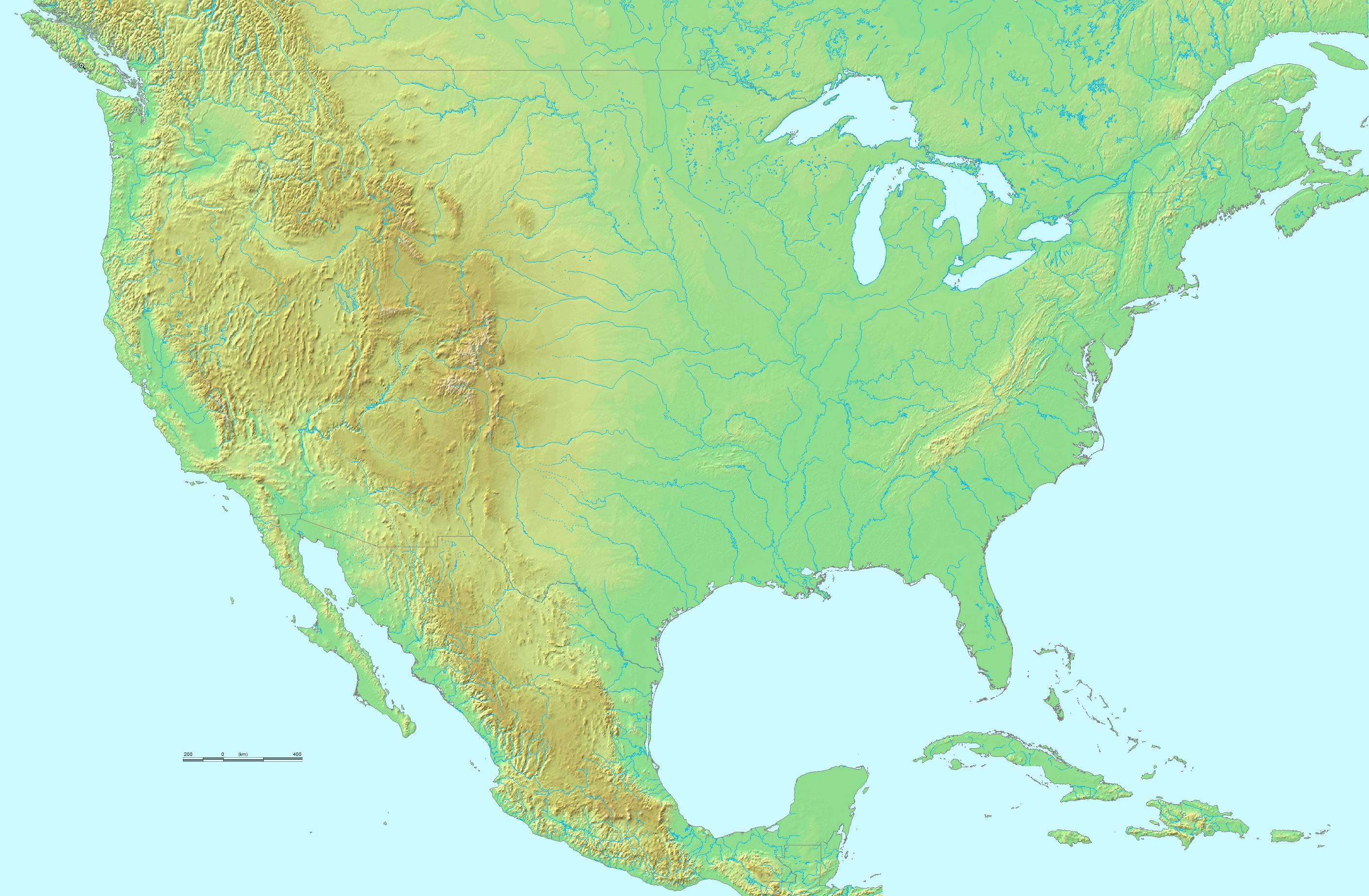
| Deskrizzjoni | Topographical map of the United States of America. |
| Sors |
http://www.demis.nl/. They grant "permission to freely copy the PNG images returned by our server and use them for your own purposes, including web pages" on this page. Their maps are based on the following public domain databases:
|
| Awtur | DEMIS BV, and uploader. |
| Verżjonijiet oħra | image:Map of USA with state names.svg |
Liċenzja
| This work has been released into the public domain by its author, demis.nl. This applies worldwide. In some countries this may not be legally possible; if so: demis.nl grants anyone the right to use this work for any purpose, without any conditions, unless such conditions are required by law.
|
Kronoloġija tal-fajl
Agħfas fuq il-grupp data/ħin biex tara l-fajl biex tara kif jidher dak il-ħin.
| Data/Ħin | Minjatura | Qisien | Utent | Kumment | |
|---|---|---|---|---|---|
| kurrenti | 03:18, 17 Novembru 2022 | | 2,814 × 1,842 (3.73 MB) | Tube of Light | Removed hand icon off the California coast |
| 23:36, 9 Novembru 2010 |  | 2,814 × 1,842 (3.89 MB) | Avenue | Cloned away hand icons | |
| 18:26, 27 Ġunju 2006 |  | 2,814 × 1,842 (3.93 MB) | Huebi~commonswiki | {{Information| |Description=Topological map of USA |other_versions=image:Map of USA with state names.svg }} Category:Maps of the United States {{PD}} |
Użu tal-fajl
Il-Paġna segwenti twassal għal din l-istampa:
L-użu globali tal-fajl
Il-wikis segwenti jużaw dan il-fajl:
- Użu fuq de.wikipedia.org
- Użu fuq fr.wikipedia.org
- Użu fuq fr.wikiversity.org
- Użu fuq ksh.wikipedia.org
- Użu fuq mwl.wikipedia.org
- Użu fuq uk.wikipedia.org