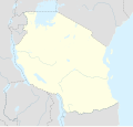
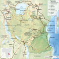
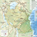
Stampa:Tanzania location map.svg

Page contents not supported in other languages.
Minn Wikipedija, l-enċiklopedija l-ħielsa

Fajl oriġinali(Fajl fil-format SVG, dimensjoni nominali 3,302 × 3,143 pixel, dimensjoni tal-fajl: 1.04 MB)

Dan huwa fajl mill-Wikimedia Commons. Il-deskrizzjoni fuq il-paġna ta' diskussjoni oriġinali tidher hawn taħt.
Commons huwa repożitorju ta' fajls multimedjali liċenzjati b'xejn. Int tista' tgħin.

Taqsira

Deskrizzjoni
Afrikaans: Liggingkaart van Tanzanië
English: Location map of Tanzania
Español: Mapa de georreferenciación de Tanzania
Français : Carte de géolocalisation de la Tanzanie
Equirectangular projection. 0.25° N, 28° W, 42° E, -13° S. Center : -6.375 35
Data (UTC)
Sors
Awtur
Verżjonijiet oħra

Derivative works of this file:  Iringa Regionen.png [editja]

Attribuzzjoni
(required by the license)
InfoField
© Sémhur / Wikimedia Commons / 
© Sémhur / Wikimedia Commons
SVG
InfoField
 
W3C-validity not checked.
 
This W3C-unspecified vector image was created with Inkscape…important .
This is a retouched picture, which means that it has been digitally altered from its original version. Modifications: Cropped, and prepared for geolocation.. The original can be viewed here: Tanzania map-fr.svg. Modifications made by Sémhur.

Graphic Lab
InfoField
Object location6° 22′ 30″ S, 35° 00′ 00″ E  Heading=1° Kartographer map based on OpenStreetMap.View this and other nearby images on: OpenStreetMapinfo

Liċenzja

Jiena, id-detentur tal-copyright ta' dan ix-xogħol, niddikjara li se nippubblikah taħt il-liċenzji segwenti:
w:mt:Creative Commons
attribuzzjoni Ixxerja bl-istess mod
This file is licensed under the Creative Commons Attribution-Share Alike Attribution-Share Alike 4.0 International, 3.0 Unported, 2.5 Generic, 2.0 Generic and 1.0 Generic license.
Inti ħieles:
  • li taqsam – li tikkopja, tiddistribwixxi u tittrażmetti din l-opra
  • li timmodifika – li tadatta l-biċċa xogħol
Taħt il-kundizzjonijiet segwenti:
  • attribuzzjoni – Għandek tattribwixxi x-xogħol bil-mod speċifikat mill-awtur jew minn min ta l-l-iċenzja (imma mhux b'xi mod li jissuġġerixxi ji jappoġjaw lilek jew l-użu tax-xogħol).
  • Ixxerja bl-istess mod – Jekk tbiddel, tittrasforma jew tibni fuq dan il-materjal, inti għandek bżonn taqsam il-kontribuzzjonijiet tiegħek taħt l-istess liċenzja jew waħda li taqbel ma' dik oriġinali.
Licence Art Libre Copyleft: This work of art is free; you can redistribute it and/or modify it according to terms of the Free Art License. You will find a specimen of this license on the Copyleft Attitude site as well as on other sites.
Tista' tagħżel il-liċenzja li tippreferi.

Original upload log

This image is a derivative work of the following images:

  • File:Tanzania_map-fr.svg licensed with Cc-by-sa-3.0,2.5,2.0,1.0, GFDL
    • 2009-03-20T13:30:18Z Sémhur 3096x3113 (3225659 Bytes) Ol Doinyo Lengaï was misplaced
    • 2009-03-20T11:14:35Z Sémhur 3096x3113 (3224368 Bytes) Add location map and few summits.
    • 2009-03-19T17:14:13Z Sémhur 3096x3113 (3099209 Bytes) grrr...
    • 2009-03-19T17:08:18Z Sémhur 3096x3113 (3099244 Bytes) Oups ! It wasn't the valid one.
    • 2009-03-19T17:05:02Z Sémhur 3096x3113 (3122421 Bytes) {{Information |Description={{en|1=Map of [[:en:Tanzania]].}} {{fr|1=Carte de la [[:fr:Tanzanie]].}} {{es|1=Mapa de [[:es:Tanzania]].}} |Source=travail personnel (own work). Sources of data: * Elevations : NASA SRTM3 (public d

Uploaded with derivativeFX

Original upload log

date/time username resolution size edit summary
2009-05-03T08:48:31Z User:Sémhur 3096×2947 828.71Kb borders above waters
2009-05-03T08:45:18Z User:Sémhur 3096×2947 828.72Kb Adding border between Arusha and Manyara
2009-05-01T18:46:42Z User:Sémhur 3096×2947 822.6Kb {{int:summary}} {{Information |Description={{en|1=Location map of [[:en:Tanzania]].}} {{fr|1=Carte de géolocalisation de la [[:fr:Tanzanie]].}} {{es|1=Mapa de georreferenciación de [[:es:Tanzania]].}} Equirectangular projection. 0.25° N, 28° W, 42°

Captions

Add a one-line explanation of what this file represents
Location map of Tanzania

Items portrayed in this file

depicts Ingliż

copyrighted Ingliż

1 Mejju 2009

6°S, 35°E

heading Ingliż: 1 grad

media type Ingliż

image/svg+xml

Kronoloġija tal-fajl

Agħfas fuq il-grupp data/ħin biex tara l-fajl biex tara kif jidher dak il-ħin.

Data/ĦinMinjaturaQisienUtentKumment
kurrenti20:15, 25 Mejju 2017Minjatura tal-verżjoni ta' 20:15, 25 Mejju 20173,302 × 3,143 (1.04 MB)SémhurUpdated with Songwe Region
14:16, 13 Diċembru 2013Minjatura tal-verżjoni ta' 14:16, 13 Diċembru 20133,096 × 2,947 (1.03 MB)SémhurUpdated with the four new regions
00:30, 25 Lulju 2009Minjatura tal-verżjoni ta' 00:30, 25 Lulju 20093,096 × 2,947 (829 KB)BetacommandBotmove approved by: User:Sémhur This image was moved from File:Tanzania location equirectangular map.svg =={{int:summary}}== {{Information |Description={{en|1=Location map of en:Tanzania.}} {{fr|1=Carte de géolocalisation de la [[:fr:Tanz

Il-2 paġni segwenti jwasslu għal din l-istampa:

L-użu globali tal-fajl

Metadati