
Stampa:Prefecture map of Crete (Greece).svg

Size of this PNG preview of this SVG file: 693 × 599 pixels. Riżoluzzjonijiet oħra: 278 × 240 pixels | 555 × 480 pixels | 888 × 768 pixels | 1,184 × 1,024 pixels | 2,369 × 2,048 pixels | 8,460 × 7,315 pixels
Fajl oriġinali (Fajl fil-format SVG, dimensjoni nominali 8,460 × 7,315 pixel, dimensjoni tal-fajl: 1.82 MB)
| Dan huwa fajl mill-Wikimedia Commons. Il-deskrizzjoni fuq il-paġna ta' diskussjoni oriġinali tidher hawn taħt.
|
.svg)
Taqsira
| Deskrizzjoni |
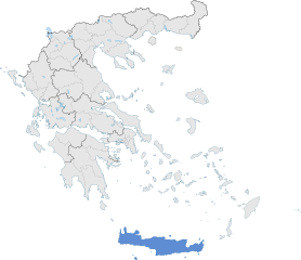
English: The prefecture of Crete within Greece. |
| Data | |
| Sors | Opra proprja |
| Awtur | SilentResident,Philly boy92 |
Liċenzja
Jiena, id-detentur tal-copyright ta' dan ix-xogħol, niddikjara li se nippubblikah taħt il-liċenzja segwenti:
Dan il-fajl huwa liċenzjat taħt it-termini tal-liċenzja Creative Commons Attribuzzjoni-Aqsam bl-istess mod 3.0 Unported
- Inti ħieles:
- li taqsam – li tikkopja, tiddistribwixxi u tittrażmetti din l-opra
- li timmodifika – li tadatta l-biċċa xogħol
- Taħt il-kundizzjonijiet segwenti:
- attribuzzjoni – Għandek tattribwixxi x-xogħol bil-mod speċifikat mill-awtur jew minn min ta l-l-iċenzja (imma mhux b'xi mod li jissuġġerixxi ji jappoġjaw lilek jew l-użu tax-xogħol).
- Ixxerja bl-istess mod – Jekk tbiddel, tittrasforma jew tibni fuq dan il-materjal, inti għandek bżonn taqsam il-kontribuzzjonijiet tiegħek taħt l-istess liċenzja jew waħda li taqbel ma' dik oriġinali.
Kronoloġija tal-fajl
Agħfas fuq il-grupp data/ħin biex tara l-fajl biex tara kif jidher dak il-ħin.
| Data/Ħin | Minjatura | Qisien | Utent | Kumment | |
|---|---|---|---|---|---|
| kurrenti | 18:00, 17 Jannar 2015 | | 8,460 × 7,315 (1.82 MB) | SilentResident | The Map has been updated to include some missing territories of Greece; fixed outline and color differences for some Greek islands in the Ionian and Aegean Seas that could confuse the readers. |
| 22:34, 16 Jannar 2015 |  | 7,304 × 7,315 (1.74 MB) | SilentResident | {{Information |Description ={{en|1=The prefecture of Crete within Greece.}} |Source ={{own}} |Author =SilentResident,Philly boy92 |Date =2014-01-16 |Permission = |other_vers... |
Użu tal-fajl
Il-Paġna segwenti twassal għal din l-istampa:
L-użu globali tal-fajl
Il-wikis segwenti jużaw dan il-fajl:
- Użu fuq ar.wikipedia.org
- Użu fuq ast.wikipedia.org
- Użu fuq ca.wikipedia.org
- Użu fuq diq.wikipedia.org
- Użu fuq el.wikipedia.org
- Użu fuq en.wikipedia.org
- Użu fuq en.wikivoyage.org
- Użu fuq eu.wikipedia.org
- Użu fuq fi.wiktionary.org
- Użu fuq ga.wikipedia.org
- Użu fuq gl.wikipedia.org
- Użu fuq ha.wikipedia.org
- Użu fuq hy.wikipedia.org
- Użu fuq hyw.wikipedia.org
- Użu fuq ia.wikipedia.org
- Użu fuq la.wikipedia.org
- Użu fuq lb.wikipedia.org
- Użu fuq mzn.wikipedia.org
- Użu fuq tr.wikipedia.org
- Użu fuq tt.wikipedia.org
- Użu fuq www.wikidata.org
.svg)