
Stampa:Mitchell Map-excerpt03.jpg
Fajl oriġinali (2,188 × 1,600 pixel, dimensjoni: 872 KB, tip ta' MIME: image/jpeg)
| Dan huwa fajl mill-Wikimedia Commons. Il-deskrizzjoni fuq il-paġna ta' diskussjoni oriġinali tidher hawn taħt.
|
Taqsira
| Deskrizzjoni |
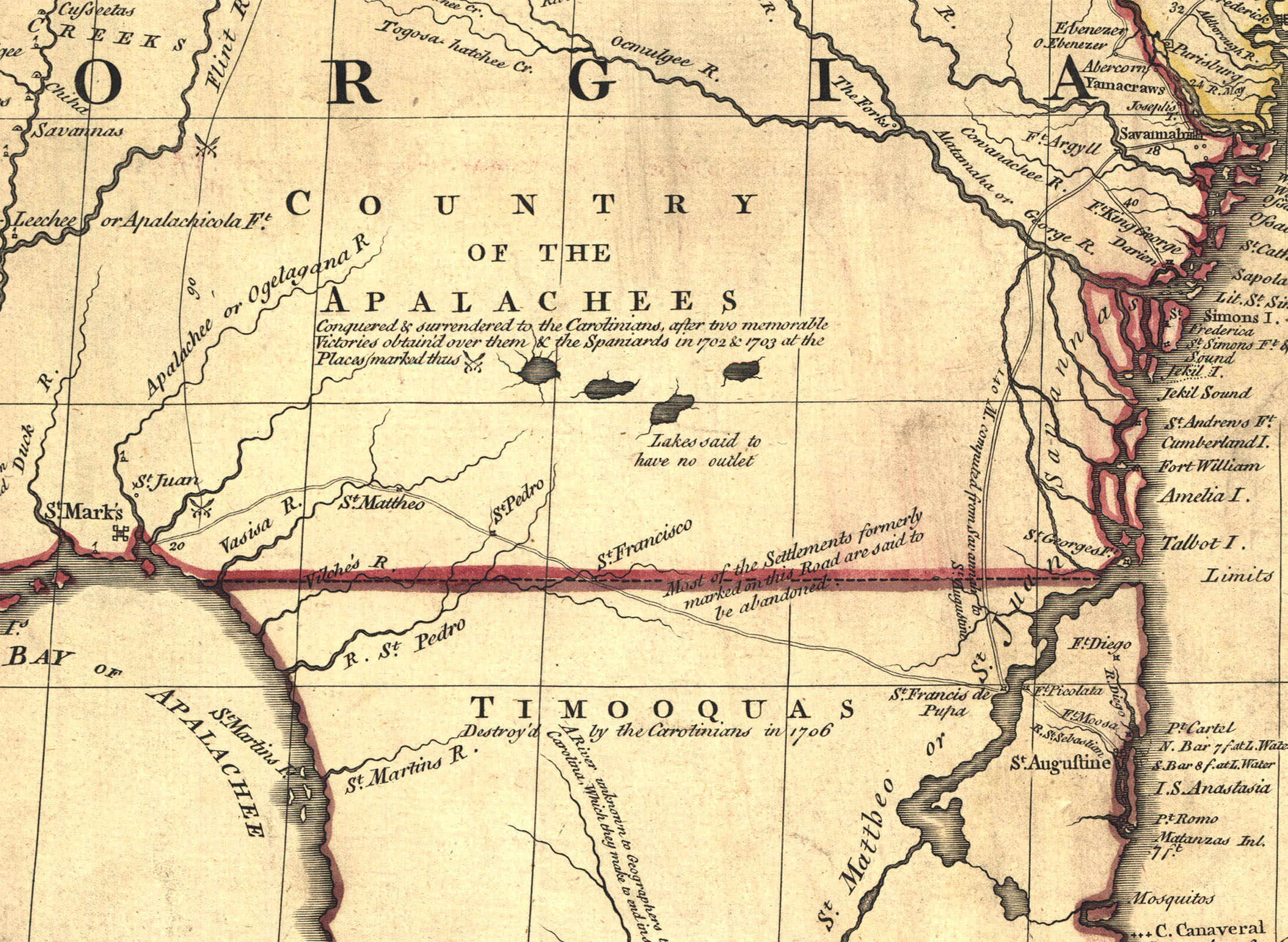
A part of the Mitchell Map - A map of the British and French dominions in North America,...; 1757 Shows boundary of Florida and Georgia. |
||
| Data | 1755 - 1757 | ||
| Sors |
|
||
| Awtur | John Mitchell; digital version, Library of Congress, Geography and Map Division. | ||
| Verżjonijiet oħra |


Liċenzja
This image is in the public domain because it is a mere mechanical scan or photocopy of a public domain original, or – from the available evidence – is so similar to such a scan or photocopy that no copyright protection can be expected to arise. The original itself is in the public domain for the following reason:
This tag is designed for use where there may be a need to assert that any enhancements (eg brightness, contrast, colour-matching, sharpening) are in themselves insufficiently creative to generate a new copyright. It can be used where it is unknown whether any enhancements have been made, as well as when the enhancements are clear but insufficient. For known raw unenhanced scans you can use an appropriate {{PD-old}} tag instead. For usage, see Commons:When to use the PD-scan tag.  | ||||
Kronoloġija tal-fajl
Agħfas fuq il-grupp data/ħin biex tara l-fajl biex tara kif jidher dak il-ħin.
| Data/Ħin | Minjatura | Qisien | Utent | Kumment | |
|---|---|---|---|---|---|
| kurrenti | 07:52, 19 Ottubru 2006 | | 2,188 × 1,600 (872 KB) | Pfly | {{Information |Description= A part of the Mitchell Map - A map of the British and French dominions in North America,...; 1757 |Source= http://hdl.loc.gov/loc.gmd/g3300.ar004000 |Date= 1755-1757 |Author= John Mitchell; digital version, Library of Congress, |
Użu tal-fajl
Il-Paġna segwenti twassal għal din l-istampa:
L-użu globali tal-fajl
Il-wikis segwenti jużaw dan il-fajl:
- Użu fuq de.wikipedia.org
- Użu fuq en.wikipedia.org
- Użu fuq gl.wikipedia.org
- Użu fuq he.wikipedia.org
- Użu fuq it.wikipedia.org
- Użu fuq pt.wikipedia.org
- Użu fuq sv.wikipedia.org