Aqbeż għall-kontentut

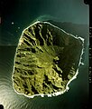
Stampa:Minami Iwo To 1978.jpg

Page contents not supported in other languages.
Minn Wikipedija, l-enċiklopedija l-ħielsa

Fajl oriġinali (3,498 × 3,969 pixel, dimensjoni: 1.96 MB, tip ta' MIME: image/jpeg)

Dan huwa fajl mill-Wikimedia Commons. Il-deskrizzjoni fuq il-paġna ta' diskussjoni oriġinali tidher hawn taħt.
Commons huwa repożitorju ta' fajls multimedjali liċenzjati b'xejn. Int tista' tgħin.

Taqsira

Deskrizzjoni

mlit-Aerial picture of Minami-Iwojima, Volcano Islands, Japan

日本語: 南硫黄島の航空写真。
Data
Sors
Awtur
日本語: 国土交通省
Attribution information, such as the author's name, e-mail, website, or signature, that was once visible in the image itself has been moved into the image metadata and/or image description page. This makes the image easier to reuse and more language-neutral, and makes the text easier to process and search for. Commons discourages placing visible author information in images.

Indonesia | العربيَّة | Boarisch | беларуская (тарашкевіца)‎ | বাংলা | català | čeština | Deutsch | Ελληνικά | English | español | eesti | فارسی | suomi | français | עברית | magyar | italiano | 한국어 | македонски | മലയാളം | Plattdüütsch | Nederlands | polski | português | português do Brasil | русский | sicilianu | slovenščina | தமிழ் | Türkçe | 中文 | +/−

Liċenzja

© Id-detentur tal-copyright ta' dan il-fajl, the Ministry of Land, Infrastructure, Transport and Tourism of Japan, iħalli lil kulħadd jużah għal kwalunkwe raġuni, bil-kundizzjoni li d-detentur tal-copyright huwa attribwit. Id-distribuzzjoni mill-ġdid, xogħol derivat, użu kummerċjali, u kwalunkwe użu ieħor huwa permess.
Attribuzzjoni:
Copyright © National Land Image Information (Color Aerial Photographs), Ministry of Land, Infrastructure, Transport and Tourism

Notice
This image is copyrighted by the Ministry of Land, Infrastructure, Transport and Tourism of Japan. For terms of use, see the stipulation to use of National Land Information (in Japanese) and message from MLIT (in Japanese and English). When you display this image on an article, include the following phrase in the description: "Made based on National Land Image Information (Color Aerial Photographs), Ministry of Land, Infrastructure, Transport and Tourism".

Captions

Add a one-line explanation of what this file represents

Items portrayed in this file

depicts Ingliż

copyrighted Ingliż

Kronoloġija tal-fajl

Agħfas fuq il-grupp data/ħin biex tara l-fajl biex tara kif jidher dak il-ħin.

Data/ĦinMinjaturaQisienUtentKumment
kurrenti17:47, 29 Awwissu 2014Minjatura tal-verżjoni ta' 17:47, 29 Awwissu 20143,498 × 3,969 (1.96 MB)Vanteylosslessly cropped watermark from first version
13:18, 13 Mejju 2006Minjatura tal-verżjoni ta' 13:18, 13 Mejju 20061,030 × 1,181 (1.01 MB)Σ64
13:16, 13 Mejju 2006Minjatura tal-verżjoni ta' 13:16, 13 Mejju 20063,679 × 4,336 (2.14 MB)Σ64南硫黄島の航空写真。 {{AerialPhotograph-mlitJP}}

Il-Paġna segwenti twassal għal din l-istampa:

L-użu globali tal-fajl

Il-wikis segwenti jużaw dan il-fajl:

Metadati