
Stampa:Lake lanier satellite map.jpg
Daqs tad-dehra proviżorja: 407 × 599 pixels. Riżoluzzjonijiet oħra: 163 × 240 pixels | 576 × 848 pixels
Fajl oriġinali (576 × 848 pixel, dimensjoni: 114 KB, tip ta' MIME: image/jpeg)
| Dan huwa fajl mill-Wikimedia Commons. Il-deskrizzjoni fuq il-paġna ta' diskussjoni oriġinali tidher hawn taħt.
|
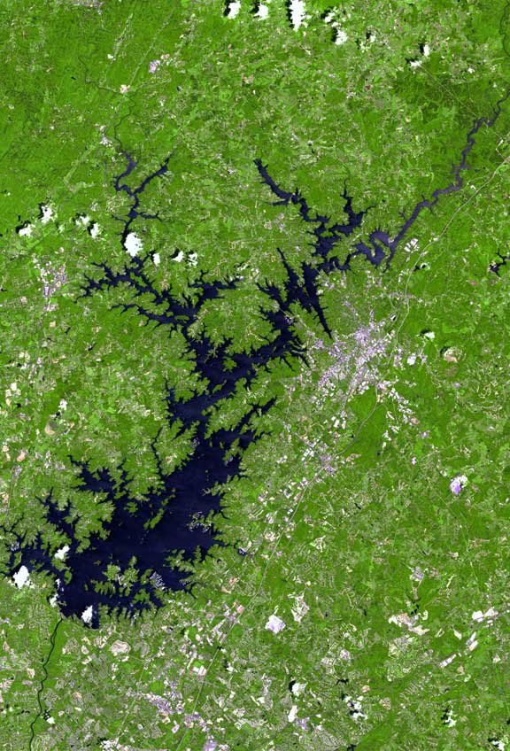
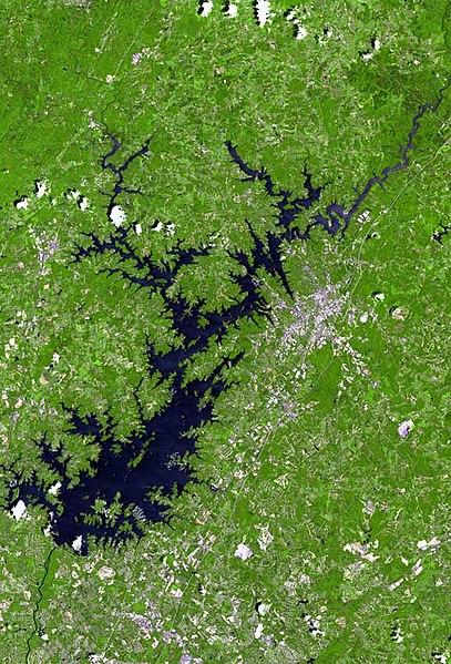
| Deskrizzjoni | The raw satellite imagery shown in these images was obtain from NASA and/or the US Geological Survey. Post-processing and production by www.terraprints.com |
| Data | |
| Sors | www.terraprints.com |
| Awtur | http://www.terraprints.com |
Dan il-fajl huwa liċenzjat taħt it-termini tal-liċenzja Creative Commons Attribuzzjoni 2.5 Ġeneriku
- Inti ħieles:
- li taqsam – li tikkopja, tiddistribwixxi u tittrażmetti din l-opra
- li timmodifika – li tadatta l-biċċa xogħol
- Taħt il-kundizzjonijiet segwenti:
- attribuzzjoni – Għandek tattribwixxi x-xogħol bil-mod speċifikat mill-awtur jew minn min ta l-l-iċenzja (imma mhux b'xi mod li jissuġġerixxi ji jappoġjaw lilek jew l-użu tax-xogħol).
Kronoloġija tal-fajl
Agħfas fuq il-grupp data/ħin biex tara l-fajl biex tara kif jidher dak il-ħin.
| Data/Ħin | Minjatura | Qisien | Utent | Kumment | |
|---|---|---|---|---|---|
| kurrenti | 18:21, 13 Marzu 2011 | | 576 × 848 (114 KB) | Ras67 | losslessly cropped with Jpegcrop |
| 18:36, 25 Ottubru 2006 |  | 669 × 1,000 (137 KB) | Terraprints | {{Information |Description=The raw satellite imagery shown in these images was obtain from NASA and/or the US Geological Survey. Post-processing and production by http://www.terraprints.com |Source=http://www.terraprints.com |Date=20061025 |Author=http:// |
Użu tal-fajl
Il-Paġna segwenti twassal għal din l-istampa:
L-użu globali tal-fajl
Il-wikis segwenti jużaw dan il-fajl:
- Użu fuq ceb.wikipedia.org
- Użu fuq de.wikipedia.org
- Użu fuq en.wikipedia.org
- Użu fuq es.wikipedia.org
- Użu fuq fi.wikipedia.org
- Użu fuq fr.wikipedia.org
- Użu fuq hu.wikipedia.org
- Użu fuq it.wikipedia.org
- Użu fuq pt.wikipedia.org
- Użu fuq sr.wikipedia.org
- Użu fuq sv.wikipedia.org
- Użu fuq www.wikidata.org