
Stampa:KyotoMapCurrent.png
Daqs tad-dehra proviżorja: 786 × 600 pixels. Riżoluzzjonijiet oħra: 315 × 240 pixels | 629 × 480 pixels | 1,007 × 768 pixels | 1,181 × 901 pixels
Fajl oriġinali (1,181 × 901 pixel, dimensjoni: 42 KB, tip ta' MIME: image/png)
| Dan huwa fajl mill-Wikimedia Commons. Il-deskrizzjoni fuq il-paġna ta' diskussjoni oriġinali tidher hawn taħt.
|
Taqsira
| Deskrizzjoni |
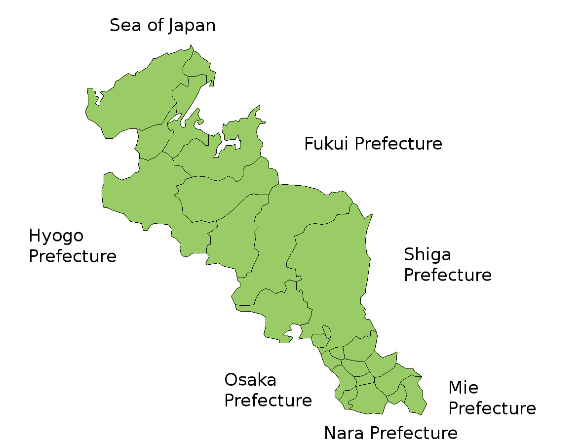
Map of Kyoto Prefecture, Japan. Thanks to Aoki Shigenobu and [1]. Colors from Image:TokyoMapCurrent.png by User:Fg2. |
| Data | 18 Lulju 2006 (original upload date) |
| Sors | No machine-readable source provided. Own work assumed (based on copyright claims). |
| Awtur | No machine-readable author provided. Akanemoto~commonswiki assumed (based on copyright claims). |
Liċenzja
| I, the copyright holder of this work, release this work into the public domain. This applies worldwide. In some countries this may not be legally possible; if so: I grant anyone the right to use this work for any purpose, without any conditions, unless such conditions are required by law. |
Kronoloġija tal-fajl
Agħfas fuq il-grupp data/ħin biex tara l-fajl biex tara kif jidher dak il-ħin.
| Data/Ħin | Minjatura | Qisien | Utent | Kumment | |
|---|---|---|---|---|---|
| kurrenti | 07:22, 14 Ġunju 2007 | | 1,181 × 901 (42 KB) | Alberth2 | Some towns merged. |
| 11:26, 18 Lulju 2006 |  | 1,181 × 901 (42 KB) | Akanemoto~commonswiki | Map of Kyoto Prefecture, Japan. Thanks to Aoki Shigenobu and [http://aoki2.si.gunma-u.ac.jp/map/map.html]. Colors from Image:TokyoMapCurrent.png by User:Fg2. Category:Maps of Kyoto prefecture Category:Maps in English |
Użu tal-fajl
L-ebda paġna fuq il-Wikipedija Maltija torbot lejn dan il-fajl.
L-użu globali tal-fajl
Il-wikis segwenti jużaw dan il-fajl:
- Użu fuq az.wikipedia.org
- Użu fuq cs.wikipedia.org
- Użu fuq eu.wikipedia.org
- Użu fuq he.wikipedia.org
- Użu fuq id.wikipedia.org
- Użu fuq lt.wikipedia.org
- Użu fuq ms.wikipedia.org
- Użu fuq no.wikipedia.org
- Użu fuq pt.wikipedia.org
- Użu fuq ru.wikipedia.org
- Użu fuq vi.wikipedia.org