
Stampa:1154 Tabula Rogeriana Al Idrisi transcripcion de Konrad Miller 1928 detalle.jpg
Mhux disponibli verżjonijiet b'risoluzzjoni akbar.
1154_Tabula_Rogeriana_Al_Idrisi_transcripcion_de_Konrad_Miller_1928_detalle.jpg (641 × 480 pixel, dimensjoni: 65 KB, tip ta' MIME: image/jpeg)
| Dan huwa fajl mill-Wikimedia Commons. Il-deskrizzjoni fuq il-paġna ta' diskussjoni oriġinali tidher hawn taħt.
|
Taqsira
| Deskrizzjoni |
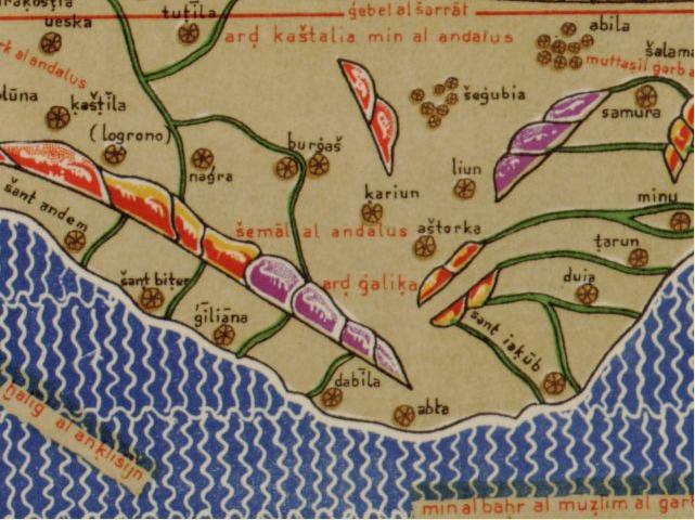
Galego: Detalle do noroeste da peninsula ibérica na Tábula Rogeriana de Al Idrisi, na transcrición latina de Konrad Miller de 1928. Pódese obter un mapa de detalle da Tábula Rogeriana na seguinte dirección á web da Libraría do Congreso dos EEUU. |
||
| Data | (original), 1928 (facsimile) | ||
| Sors |
Weltkarte des Idrisi vom Jahr 1154 n. Ch.
|
||
| Awtur |
|
||
| Verżjonijiet oħra |
|


_(original,_1154;_c%C3%B3pia,_c._1300).jpg)
_(original,_1154;_c%C3%B3pia,_c._1300).jpg)
.jpg)
Liċenzja
|
This work is in the public domain in its country of origin and other countries and areas where the copyright term is the author's life plus 70 years or fewer. This work is in the public domain in the United States because it was published (or registered with the U.S. Copyright Office) before January 1, 1929. | |
| This file has been identified as being free of known restrictions under copyright law, including all related and neighboring rights. | |
Kronoloġija tal-fajl
Agħfas fuq il-grupp data/ħin biex tara l-fajl biex tara kif jidher dak il-ħin.
| Data/Ħin | Minjatura | Qisien | Utent | Kumment | |
|---|---|---|---|---|---|
| kurrenti | 21:16, 2 Awwissu 2010 | | 641 × 480 (65 KB) | Hermericus | {{Information |Description=Detalle do noroeste da peninsula ibérica na Tábula Rogeriana de Al Idrisi, na transcripción latina de Konrad Miller de 1928. |Source=Biblioteca Nacional de Francia. |Author=Al Idrisi |Date=1154 d.C. |Permission= |other_versio |
Użu tal-fajl
Il-Paġna segwenti twassal għal din l-istampa:
L-użu globali tal-fajl
Il-wikis segwenti jużaw dan il-fajl:
- Użu fuq bg.wikipedia.org
- Użu fuq en.wikipedia.org
- Użu fuq es.wikipedia.org
- Użu fuq gl.wikipedia.org
- Użu fuq gl.wikisource.org
- Użu fuq it.wikipedia.org
- Użu fuq kn.wikipedia.org
- Użu fuq pt.wikipedia.org
- Użu fuq sq.wikipedia.org
- Użu fuq su.wikipedia.org
- Użu fuq sv.wikipedia.org
- Użu fuq th.wikipedia.org
- Użu fuq xmf.wikipedia.org