
Stampa:Korea topographic map.png
Daqs tad-dehra proviżorja: 390 × 599 pixels. Riżoluzzjonijiet oħra: 156 × 240 pixels | 312 × 480 pixels | 896 × 1,376 pixels
Fajl oriġinali (896 × 1,376 pixel, dimensjoni: 1.18 MB, tip ta' MIME: image/png)
| Dan huwa fajl mill-Wikimedia Commons. Il-deskrizzjoni fuq il-paġna ta' diskussjoni oriġinali tidher hawn taħt.
|
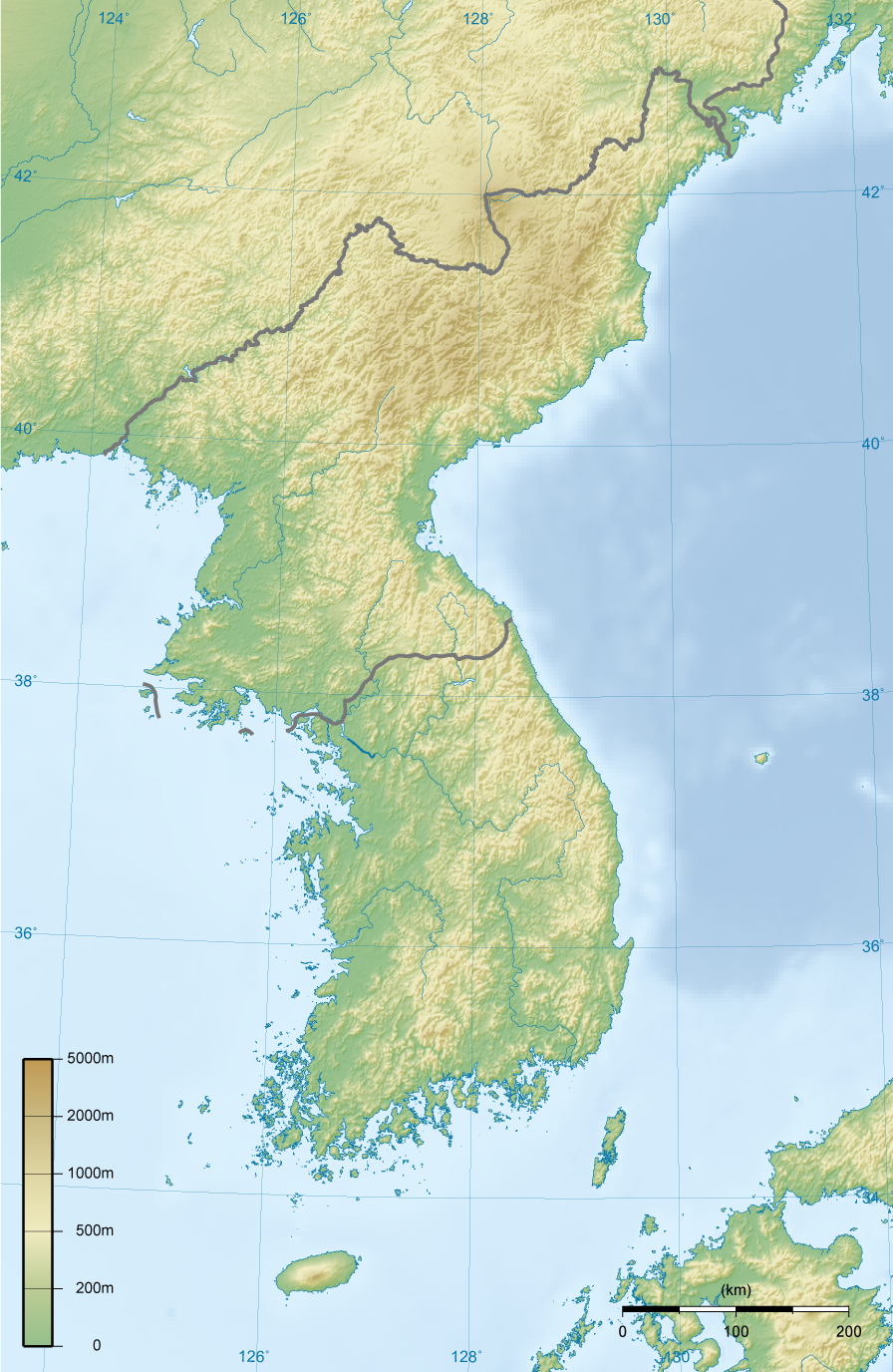
| Deskrizzjoni |
English: Topographic map of Korea.
한국어: 한국의 지형도. |
||||||||||
| Data | |||||||||||
| Sors | Opra proprja | ||||||||||
| Awtur | Ksiom | ||||||||||
| Permess (Użu mill-ġdid tal-fajl) |
|
||||||||||
| Verżjonijiet oħra | Derivative works of this file: North Korea topographic map.png |

Kronoloġija tal-fajl
Agħfas fuq il-grupp data/ħin biex tara l-fajl biex tara kif jidher dak il-ħin.
| Data/Ħin | Minjatura | Qisien | Utent | Kumment | |
|---|---|---|---|---|---|
| kurrenti | 18:00, 27 Frar 2009 | | 896 × 1,376 (1.18 MB) | Ksiom | Reverted to version as of 23:21, 21 February 2009. Unimpaired scale bar |
| 15:08, 22 Frar 2009 |  | 802 × 1,376 (1.11 MB) | Valentim | Reverted to version as of 10:45, 31 January 2009. Focused view better. | |
| 23:21, 21 Frar 2009 |  | 896 × 1,376 (1.18 MB) | Ksiom | Reverted to version as of 22:04, 13 November 2008 | |
| 10:45, 31 Jannar 2009 |  | 802 × 1,376 (1.11 MB) | Valentim | View centered on North and South Korea | |
| 22:04, 13 Novembru 2008 |  | 896 × 1,376 (1.18 MB) | Ksiom | ||
| 23:11, 16 Awwissu 2008 |  | 899 × 1,379 (1.3 MB) | Ksiom | ||
| 19:33, 15 Awwissu 2008 |  | 1,039 × 1,494 (1.36 MB) | Ksiom | ||
| 18:34, 15 Awwissu 2008 |  | 1,040 × 1,494 (1.36 MB) | Ksiom | UTM Projection | |
| 00:52, 9 Awwissu 2008 |  | 1,000 × 1,450 (1.33 MB) | Ksiom | {{Information |Description={{en|1=Topographic map of Korea.}} {{ko|1=한국의 지형도.}} |Source=Own work by uploader |Author=Ksiom |Date=2008-08-09 |Permission={{GFDL-GMT}} |other_versions= }} {{ImageUpload|full}} [[Category:Maps of Ko |
Użu tal-fajl
Il-2 paġni segwenti jwasslu għal din l-istampa:
L-użu globali tal-fajl
Il-wikis segwenti jużaw dan il-fajl:
- Użu fuq ang.wikipedia.org
- Użu fuq br.wikipedia.org
- Użu fuq da.wikipedia.org
- Użu fuq da.wikibooks.org
- Użu fuq en.wikipedia.org
- Użu fuq fr.wikipedia.org
- Użu fuq fr.wiktionary.org