
Stampa:Arrondissement de Marseille.PNG
Mhux disponibli verżjonijiet b'risoluzzjoni akbar.
Arrondissement_de_Marseille.PNG (556 × 478 pixel, dimensjoni: 17 KB, tip ta' MIME: image/png)
| Dan huwa fajl mill-Wikimedia Commons. Il-deskrizzjoni fuq il-paġna ta' diskussjoni oriġinali tidher hawn taħt.
|
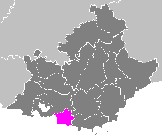
| Deskrizzjoni | Locator map of the arrondissement of Istres (before 2018) in Bouches-du-Rhône and Provence-Alpes-Côte d'Azur (France). | ||
| Data | |||
| Sors | Opra proprja | ||
| Awtur | M.Minderhoud | ||
| Permess (Użu mill-ġdid tal-fajl) |
|
Kronoloġija tal-fajl
Agħfas fuq il-grupp data/ħin biex tara l-fajl biex tara kif jidher dak il-ħin.
| Data/Ħin | Minjatura | Qisien | Utent | Kumment | |
|---|---|---|---|---|---|
| kurrenti | 17:59, 22 Novembru 2006 | | 556 × 478 (17 KB) | Michiel1972 | {{Information |Description= Maps of arrondissements and cantons of France: {{subst:PAGENAME}} |Source= |Date=november 2006 |Author= M.Minderhoud |Permission= {{PD-self}} |other_versions= }} [[Category:Maps of arrondisseme |
Użu tal-fajl
Il-Paġna segwenti twassal għal din l-istampa:
L-użu globali tal-fajl
Il-wikis segwenti jużaw dan il-fajl:
- Użu fuq arz.wikipedia.org
- Użu fuq cs.wikipedia.org
- Użu fuq es.wikipedia.org
- Użu fuq fa.wikipedia.org
- Użu fuq hy.wikipedia.org
- Użu fuq ia.wikipedia.org
- Użu fuq id.wikipedia.org
- Użu fuq it.wikipedia.org
- Użu fuq kk.wikipedia.org
- Użu fuq lb.wikipedia.org
- Użu fuq nl.wikipedia.org
- Użu fuq ru.wikipedia.org
- Użu fuq sco.wikipedia.org
- Użu fuq sk.wikipedia.org
- Użu fuq www.wikidata.org