
Stampa:Walvis Bay map.jpeg
Mhux disponibli verżjonijiet b'risoluzzjoni akbar.
Walvis_Bay_map.jpeg (372 × 420 pixel, dimensjoni: 34 KB, tip ta' MIME: image/jpeg)
| Dan huwa fajl mill-Wikimedia Commons. Il-deskrizzjoni fuq il-paġna ta' diskussjoni oriġinali tidher hawn taħt.
|
Taqsira
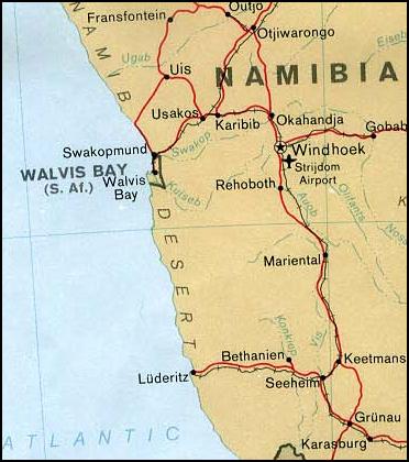
| Deskrizzjoni | Map of Walvis Bay (Namibia) | |||
| Data | ||||
| Sors | From the University of Texas PCL Map Collection [1] | |||
| Awtur | U.S. Central Intelligence Agency | |||
| Permess (Użu mill-ġdid tal-fajl) |
|

Kronoloġija tal-fajl
Agħfas fuq il-grupp data/ħin biex tara l-fajl biex tara kif jidher dak il-ħin.
| Data/Ħin | Minjatura | Qisien | Utent | Kumment | |
|---|---|---|---|---|---|
| kurrenti | 04:29, 17 April 2006 | | 372 × 420 (34 KB) | Foundert~commonswiki | {{Information| |Description=Map of Walvis Bay (Namibia) from |Source=http://www.lib.utexas.edu/maps/africa/nambia_walvis_pol78.jpg from the University of Texas |Date= 09:59, 27 September 2003 |Author=User:Pascal |Permission=This file has been released in |
Użu tal-fajl
Il-Paġna segwenti twassal għal din l-istampa:
L-użu globali tal-fajl
Il-wikis segwenti jużaw dan il-fajl:
- Użu fuq af.wikipedia.org
- Użu fuq bg.wikipedia.org
- Użu fuq ca.wikipedia.org
- Użu fuq ckb.wikipedia.org
- Użu fuq cs.wikipedia.org
- Użu fuq en.wikipedia.org
- Użu fuq es.wikipedia.org
- Użu fuq fa.wikipedia.org
- Użu fuq fi.wikipedia.org
- Użu fuq hr.wikipedia.org
- Użu fuq id.wikipedia.org
- Użu fuq io.wikipedia.org
- Użu fuq it.wikipedia.org
- Użu fuq ja.wikipedia.org
- Użu fuq ko.wikipedia.org
- Użu fuq mzn.wikipedia.org
- Użu fuq pl.wikipedia.org
- Użu fuq sco.wikipedia.org
- Użu fuq sl.wikipedia.org
- Użu fuq tg.wikipedia.org
- Użu fuq th.wikipedia.org
- Użu fuq www.wikidata.org