
Stampa:Sierra Leone location map Topographic.png

Daqs tad-dehra proviżorja: 600 × 600 pixels. Riżoluzzjonijiet oħra: 240 × 240 pixels | 622 × 622 pixels
Fajl oriġinali (622 × 622 pixel, dimensjoni: 827 KB, tip ta' MIME: image/png)
| Dan huwa fajl mill-Wikimedia Commons. Il-deskrizzjoni fuq il-paġna ta' diskussjoni oriġinali tidher hawn taħt.
|
Taqsira
| Deskrizzjoni |
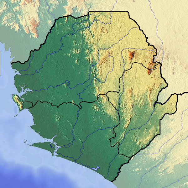
Deutsch: Positionskarte von Sierra Leone
Quadratische Plattkarte. Geographische Begrenzung der Karte:
English: Location map of Sierra Leone
Equirectangular projection. Geographic limits of the map:
|
| Data | |
| Sors |
Opra proprja
|
| Awtur | Dr Brains |
Liċenzja
Jiena, id-detentur tal-copyright ta' dan ix-xogħol, niddikjara li se nippubblikah taħt il-liċenzja segwenti:

|
Permission is granted to copy, distribute and/or modify this document under the terms of the GNU Free Documentation License, Version 1.2 only as published by the Free Software Foundation; with no Invariant Sections, no Front-Cover Texts, and no Back-Cover Texts. A copy of the license is included in the section entitled GNU Free Documentation License. | 1.2 biss |
Kronoloġija tal-fajl
Agħfas fuq il-grupp data/ħin biex tara l-fajl biex tara kif jidher dak il-ħin.
| Data/Ħin | Minjatura | Qisien | Utent | Kumment | |
|---|---|---|---|---|---|
| kurrenti | 14:11, 23 Ġunju 2012 | | 622 × 622 (827 KB) | Dr Brains |
Użu tal-fajl
Il-Paġna segwenti twassal għal din l-istampa:
L-użu globali tal-fajl
Il-wikis segwenti jużaw dan il-fajl:
- Użu fuq ar.wikipedia.org
- Użu fuq ast.wikipedia.org
- Użu fuq az.wikipedia.org
- Użu fuq bn.wikipedia.org
- Użu fuq bs.wikipedia.org
- Użu fuq ceb.wikipedia.org
- Użu fuq cs.wikipedia.org
- Użu fuq de.wikipedia.org
- Użu fuq el.wikipedia.org
- Użu fuq en.wikipedia.org
- Freetown
- Bunce Island
- Mount Bintumani
- Loma Mountains
- Outamba-Kilimi National Park
- Tiwai Island
- Western Area Peninsula National Park
- Kangari Hills Forest Reserve
- Tingi Hills Forest Reserve
- Module:Location map/data/Sierra Leone/doc
- Lake Sonfon
- Masanga Hospital
- Freetown Central Mosque
- Pujehun Central Mosque
- Bumbuna Dam
- Immaculate Heart of Mary Cathedral, Bo
- Yawri Bay
- Jamiatul Atiq Mosque
- Module:Location map/data/Sierra Leone
- Lion Mountains
- Użu fuq eo.wikipedia.org
- Użu fuq es.wikipedia.org
- Użu fuq fa.wikipedia.org
- Użu fuq fi.wikipedia.org
- Użu fuq fr.wikipedia.org
Ara l-użu globali ta' dan il-fajl.