
Stampa:Rongelap Atoll - 2014-12-06 - Landsat 8 - 15m.png
Daqs tad-dehra proviżorja: 733 × 600 pixels. Riżoluzzjonijiet oħra: 294 × 240 pixels | 587 × 480 pixels | 939 × 768 pixels | 1,252 × 1,024 pixels | 2,504 × 2,048 pixels | 3,741 × 3,060 pixels
Fajl oriġinali (3,741 × 3,060 pixel, dimensjoni: 7.88 MB, tip ta' MIME: image/png)
| Dan huwa fajl mill-Wikimedia Commons. Il-deskrizzjoni fuq il-paġna ta' diskussjoni oriġinali tidher hawn taħt.
|
Taqsira
| Deskrizzjoni |
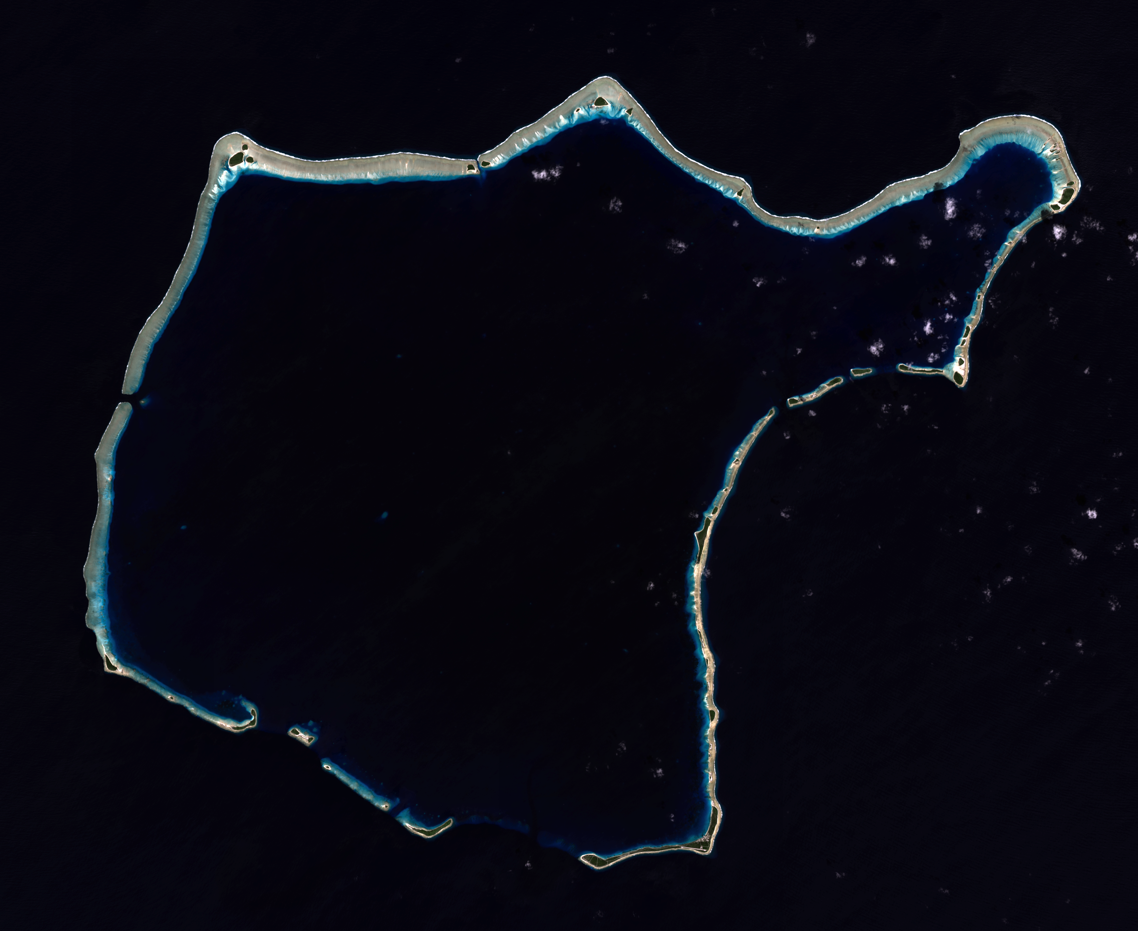
English: Composite "true color" multispectral satellite image of Rongelap Atoll.
NASA Landsat 8 OLI bands used were 4 (red), 3 (green), 2 (blue). Pan-sharpened with band 8. Manual color balance. Projection: UTM (zone 58), WGS84. Imagery courtesy NASA/USGS. (note: atmospheric haze is present and could not be fully removed) |
| Data | |
| Sors | NASA/USGS Landsat satellite image GeoTIFF archive, http://glovis.usgs.gov |
| Awtur | NASA |
| Camera location | | View this and other nearby images on: OpenStreetMap |
|---|
Liċenzja
| This file is in the public domain in the United States because it was solely created by NASA. NASA copyright policy states that "NASA material is not protected by copyright unless noted". (See Template:PD-USGov, NASA copyright policy page or JPL Image Use Policy.) | ||
 |
Warnings:
|
Kronoloġija tal-fajl
Agħfas fuq il-grupp data/ħin biex tara l-fajl biex tara kif jidher dak il-ħin.
| Data/Ħin | Minjatura | Qisien | Utent | Kumment | |
|---|---|---|---|---|---|
| kurrenti | 02:57, 22 Jannar 2015 | | 3,741 × 3,060 (7.88 MB) | Разрывные | User created page with UploadWizard |
Użu tal-fajl
Il-Paġna segwenti twassal għal din l-istampa:
L-użu globali tal-fajl
Il-wikis segwenti jużaw dan il-fajl:
- Użu fuq ast.wikipedia.org
- Użu fuq ceb.wikipedia.org
- Użu fuq en.wikipedia.org
- Użu fuq en.wikivoyage.org
- Użu fuq es.wikipedia.org
- Użu fuq fa.wikipedia.org
- Użu fuq fr.wikipedia.org
- Użu fuq fr.wiktionary.org
- Użu fuq id.wikipedia.org
- Użu fuq lv.wikipedia.org
- Użu fuq no.wikipedia.org
- Użu fuq pl.wikipedia.org
- Użu fuq uk.wikipedia.org
- Użu fuq ur.wikipedia.org
- Użu fuq www.wikidata.org