
Stampa:Monmouth Monnow Bridge cropped.jpg
Daqs tad-dehra proviżorja: 793 × 599 pixels. Riżoluzzjonijiet oħra: 318 × 240 pixels | 635 × 480 pixels | 963 × 728 pixels
Fajl oriġinali (963 × 728 pixel, dimensjoni: 564 KB, tip ta' MIME: image/jpeg)
| Dan huwa fajl mill-Wikimedia Commons. Il-deskrizzjoni fuq il-paġna ta' diskussjoni oriġinali tidher hawn taħt.
|
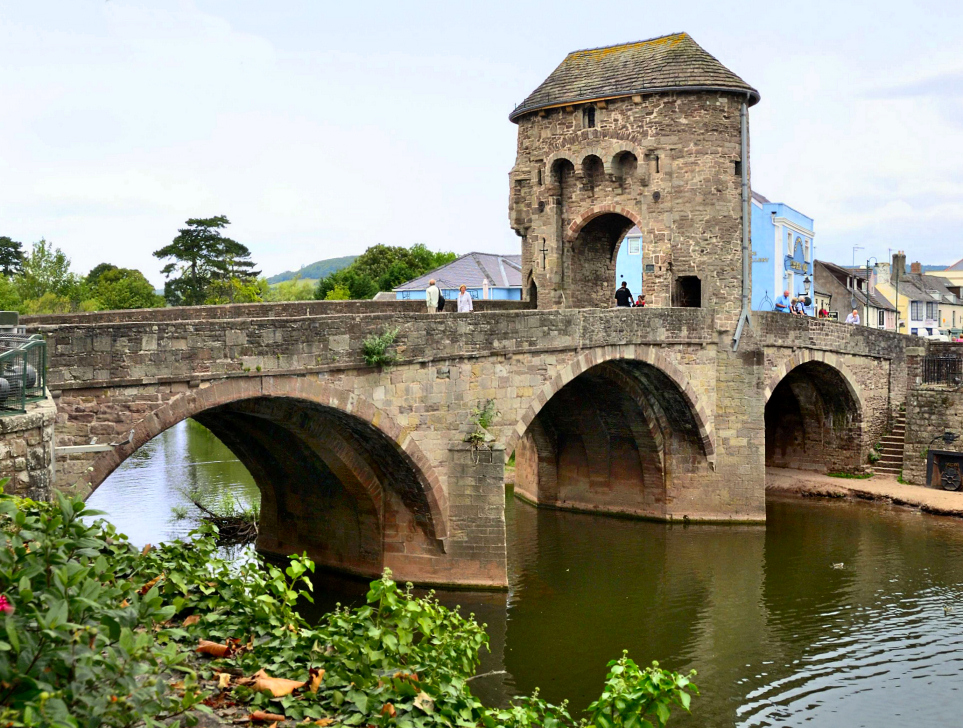
| Deskrizzjoni | Monnow Bridge is a medieval bridge over the namesake river Monnow in the town of Monmouth, Wales. The existing bridge was completed in the late 13th century. It is the only remaining medieval fortified bridge in Britain. | ||
| Data | |||
| Sors | Flickr: Monmouth - Monnow Bridge | ||
| Awtur | Bob Crowther | ||
| Permess (Użu mill-ġdid tal-fajl) |
Dan il-fajl huwa liċenzjat taħt it-termini tal-liċenzja Creative Commons Attribuzzjoni 2.0 Ġeneriku
|
||
| Verżjonijiet oħra |

| Camera location | | View this and other nearby images on: OpenStreetMap |
|---|

|
This image has been assessed under the valued image criteria and is considered the most valued image on Commons within the scope: Monnow Bridge, Monmouth. You can see its nomination here. |
Kronoloġija tal-fajl
Agħfas fuq il-grupp data/ħin biex tara l-fajl biex tara kif jidher dak il-ħin.
| Data/Ħin | Minjatura | Qisien | Utent | Kumment | |
|---|---|---|---|---|---|
| kurrenti | 21:06, 5 Ġunju 2012 | | 963 × 728 (564 KB) | AxelHH | {{Information |Description ={{de|1=dfsf}} |Source ={{own}} |Author =AxelHH |Date = |Permission = |other_versions = }} |
Użu tal-fajl
Il-Paġna segwenti twassal għal din l-istampa:
L-użu globali tal-fajl
Il-wikis segwenti jużaw dan il-fajl:
- Użu fuq cy.wikipedia.org
- Użu fuq de.wikipedia.org
- Użu fuq en.wikipedia.org
- Użu fuq en.wiktionary.org
- Użu fuq es.wikipedia.org
- Użu fuq fi.wikipedia.org