
Stampa:Kaukasus.jpg

Daqs tad-dehra proviżorja: 776 × 600 pixels. Riżoluzzjonijiet oħra: 311 × 240 pixels | 621 × 480 pixels | 994 × 768 pixels | 1,280 × 989 pixels | 2,560 × 1,978 pixels | 4,400 × 3,400 pixels
Fajl oriġinali (4,400 × 3,400 pixel, dimensjoni: 2.35 MB, tip ta' MIME: image/jpeg)
| Dan huwa fajl mill-Wikimedia Commons. Il-deskrizzjoni fuq il-paġna ta' diskussjoni oriġinali tidher hawn taħt.
|
Ḝ== Taqsira ==
| Deskrizzjoni |
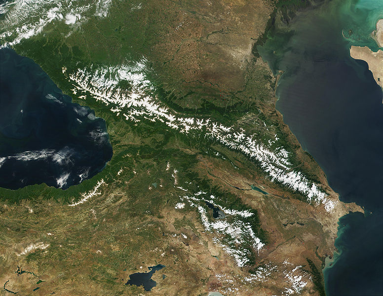
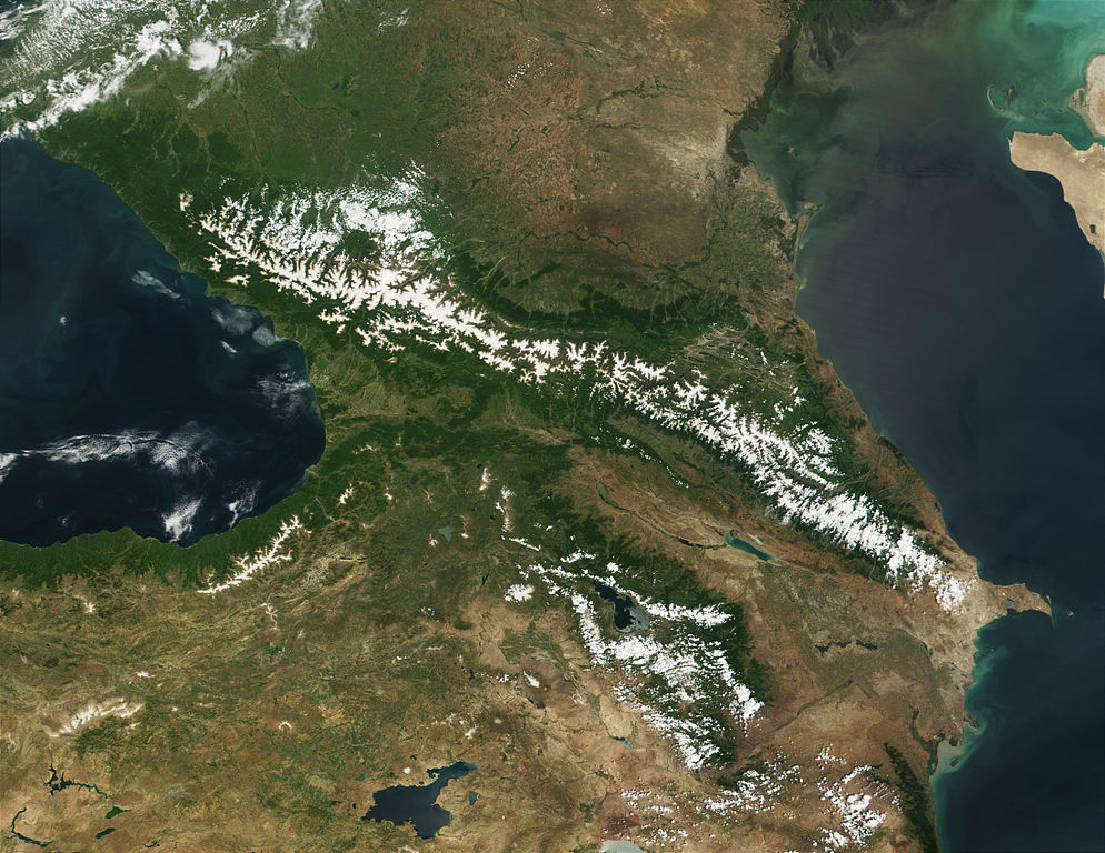
Deutsch: Satellitenaufnahme des Kaukasus von NASAs Visible Earth English: Satellite image of the Caucasus, from NASA’s Visible Earth |
| Data | |
| Sors | http://visibleearth.nasa.gov/view_rec.php?id=1939 |
| Awtur | NASA/MODIS - Jacques Descloitres, MODIS Land Rapid Response Team |
| Permess (Użu mill-ġdid tal-fajl) |
Public Domain |
Liċenzja
| This file is in the public domain in the United States because it was solely created by NASA. NASA copyright policy states that "NASA material is not protected by copyright unless noted". (See Template:PD-USGov, NASA copyright policy page or JPL Image Use Policy.) | ||
 |
Warnings:
|
Version history
| date/time | username | edit summary |
|---|---|---|
| 05:58, 4. Feb 2006 | de:Benutzer:Denniss | |
| 00:36, 23. Dez 2005 | de:Benutzer:Zwobot | (Bot: ersetze Flaggen durch SVG-Versionen) |
| 11:13, 12. Feb 2005 | de:Benutzer:ChrisM | (PD-Lizenz) |
| 16:27, 7. Sep 2004 | de:Benutzer:80.78.231.68 | |
| 16:26, 7. Sep 2004 | de:Benutzer:80.78.231.68 | |
| 20:43, 30. Jul 2004 | de:Benutzer:ChrisM | (Beschreibung) |
| 20:42, 30. Jul 2004 | de:Benutzer:ChrisM |
Original upload log
Legende: (Aktuell) = dies ist das aktuelle Bild, (Löschen) = lösche diese alte Version, (Zurücksetzen) = verwende wieder diese alte Version.
- (Löschen) (Aktuell) 20:42, 30. Jul 2004 . . de:Benutzer:ChrisM ChrisM ( de:Benutzer_Diskussion:ChrisM Diskussion) . . 1100 x 850 (177902 Byte)
Kronoloġija tal-fajl
Agħfas fuq il-grupp data/ħin biex tara l-fajl biex tara kif jidher dak il-ħin.
| Data/Ħin | Minjatura | Qisien | Utent | Kumment | |
|---|---|---|---|---|---|
| kurrenti | 00:50, 8 Lulju 2009 | | 4,400 × 3,400 (2.35 MB) | Martin H. | high res |
| 20:49, 25 Marzu 2006 |  | 1,100 × 850 (174 KB) | Maksim | La bildo estas kopiita de wikipedia:de. La originala priskribo estas: Satellitenaufnahme des Kaukasus von NASA’s Visible Earth in Public Domain Fundstelle: http://visibleearth.nasa.gov/cgi-bin/viewrecord?9035 {{PD-USGov}} {| border="1" ! date/time | |
Użu tal-fajl
Il-4 paġni segwenti jwasslu għal din l-istampa:
L-użu globali tal-fajl
Il-wikis segwenti jużaw dan il-fajl:
- Użu fuq ady.wikipedia.org
- Użu fuq af.wikipedia.org
- Użu fuq als.wikipedia.org
- Użu fuq ar.wikipedia.org
- Użu fuq arz.wikipedia.org
- Użu fuq av.wikipedia.org
- Użu fuq azb.wikipedia.org
- Użu fuq az.wikipedia.org
- Użu fuq az.wiktionary.org
- Użu fuq be-tarask.wikipedia.org
- Użu fuq bg.wikipedia.org
- Użu fuq bh.wikipedia.org
- Użu fuq bn.wikipedia.org
- Użu fuq br.wikipedia.org
- Użu fuq bs.wikipedia.org
- Użu fuq ca.wikipedia.org
- Użu fuq ckb.wikipedia.org
- Użu fuq csb.wikipedia.org
- Użu fuq cs.wikipedia.org
- Użu fuq cv.wikipedia.org
- Użu fuq da.wikipedia.org
- Użu fuq de.wikipedia.org
Ara l-użu globali ta' dan il-fajl.