
Stampa:Modiin1870s.jpg
Daqs tad-dehra proviżorja: 627 × 599 pixels. Riżoluzzjonijiet oħra: 251 × 240 pixels | 502 × 480 pixels | 803 × 768 pixels | 1,094 × 1,046 pixels
Fajl oriġinali (1,094 × 1,046 pixel, dimensjoni: 245 KB, tip ta' MIME: image/jpeg)
| Dan huwa fajl mill-Wikimedia Commons. Il-deskrizzjoni fuq il-paġna ta' diskussjoni oriġinali tidher hawn taħt.
|
Taqsira
| Deskrizzjoni |
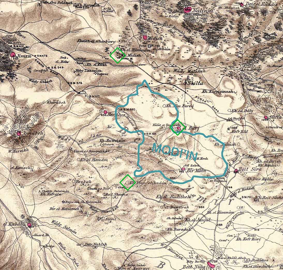
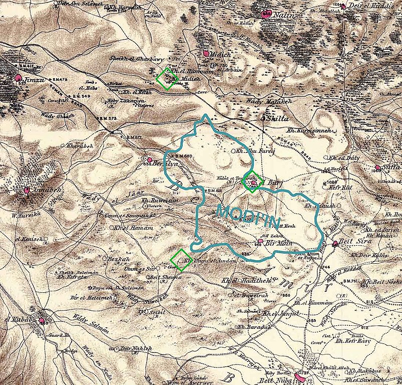
Combination of portions of two maps produced by the Survey of Western Palestine, first published in 1880 by the Committee of the Palestine Exploration Fund. The editor, Walter Besant, died in 1901. The blue shape gives the approximate boundaries of the build-up area of Modi'in in 2006 (Google Earth). The green diamonds show three scientific theories regarding the location of the ancient city of Modi'in. There are other popular theories. Produced by Zero0000 using Photoshop 7.0. |
| Data | 28 Jannar 2007 (original upload date) |
| Sors | No machine-readable source provided. Own work assumed (based on copyright claims). |
| Awtur | No machine-readable author provided. Zero0000 assumed (based on copyright claims). |
Liċenzja
| I, the copyright holder of this work, release this work into the public domain. This applies worldwide. In some countries this may not be legally possible; if so: I grant anyone the right to use this work for any purpose, without any conditions, unless such conditions are required by law. |
Kronoloġija tal-fajl
Agħfas fuq il-grupp data/ħin biex tara l-fajl biex tara kif jidher dak il-ħin.
| Data/Ħin | Minjatura | Qisien | Utent | Kumment | |
|---|---|---|---|---|---|
| kurrenti | 10:08, 28 Jannar 2007 | | 1,094 × 1,046 (245 KB) | Zero0000 | Combination of portions of two maps produced by the Survey of Western Palestine, first published in 1880 by the Committee of the Palestine Exploration Fund. The editor, Walter Besant, died in 1901. The blue shape gives the approximate boundaries of the b |
Użu tal-fajl
Il-Paġna segwenti twassal għal din l-istampa:
L-użu globali tal-fajl
Il-wikis segwenti jużaw dan il-fajl:
- Użu fuq cs.wikipedia.org
- Użu fuq el.wikipedia.org
- Użu fuq en.wikipedia.org
- Użu fuq he.wikipedia.org
- Użu fuq id.wikipedia.org
- Użu fuq nn.wikipedia.org
- Użu fuq no.wikipedia.org
- Użu fuq pl.wikipedia.org
- Użu fuq sco.wikipedia.org